Guide to Arts District
Between San Pedro and the L.A. River, Central City East was soon covered with large factories and warehouses. By 1950, Los Angeles was an industrial powerhouse where more… cars were assembled than in any American city besides Detroit. The city’s tire production was only exceeded by that of Akron. Los Angeles also outranked all American cities in garment production except for New York City. As the population of the city swelled, much of the industry and especially the residential population center moved away from the city center, leaving behind many massive empty buildings. In the late ‘60s, many returning emotionally-disturbed and drug-addicted Viet Nam vets joined the older, by then permanent population of alcoholic ex-hobos, tramps and bums. Many missions had long serviced the indigent area and the mostly abandoned industrial area became a hotbed for those both dropping out of society and those expelled. Not all of the industrial core was abandoned and as different areas took on different characteristics are still organized around smaller districts, including The Wholesale District (an area where most of the produce, seafood and flowers pass into the city), Skid Row (an area where most of the county’s 10,000 or so homeless pass through), The Fashion District (formerly known as The Garment District), The Toy District and -- on the eastern edge -- The Arts District. Not all of the district's borders have been accepted by all parties. Since it became a highly desirable area, developers have continually attempted to stretch its borders so that they can convert and sell more properties. The western border has always been accepted as Alameda. The eastern border has always been accepted as the L.A. River. Though the northern border is defined in city documents as 1st Street, both Temple and the 101 have also been described as the border and even appear as such in some unofficial maps. Confusingly, the only "Arts District" signs in the area are located at Hewitt & Traction and at 3rd & Santa Fe, intersections several blocks south of anyone's definition. In 2000, the Central City North Community Plan officially set “Artists-in-Residence District’s” southern boundary at 6th street. Then, in 2007, the southern boundary was officially extended several blocks further to Violet St. It is bordered by the Civic Center to the north, Boyle Heights to to east, the Wholesale District to the south, the Downtown Industrial District to the southwest, and Little Tokyo to the northwest. More
 | Anime Expo 2019-9254")


Popular in Arts District
Add Your Listing

Nearby Neighborhoods
-
1
Bac Squared Incorporated
Restaurants -
2
Acadian Fish Company
Restaurants -
3
Tony's Cocktails
Restaurants -
4
Tarryn Teresa Gallery
Attractions -
5
City Hearts-kids Say Yes-arts
Attractions
-
1
Bac Squared Incorporated
701 E 3rd St -
2
Acadian Fish Company
1375 E 6th St -
3
Tony's Cocktails
2017 E 7th St -
4
Eat.drink.americano
923 East 3rd St. #101 -
5
French Garden
1936 E 7th St -
6
Italian Fabric
561 Mateo St -
7
Honda Ya Izakaya
333 South Alameda Street #314 -
8
Hans Bibimbap
333 S Alameda St -
9
Royal Claytons Restaurant
1855 Industrial St -
10
Ttc Inc.
1232 Factory Pl -
11
Simple Touch Wireless
333 S Alameda St -
12
L A Scoops Ice Cream
333 S Alameda St -
13
Tsukasa Sushi
333 S Alameda St -
14
R And R Seafood
1567 Industrial St -
15
R-23
923 E 3rd St -
16
Ktownbbq
738 E 3rd St -
17
Pacific Blue Seafood
152 S Mission Rd -
18
Southeast Ocean Seafood Inc.
1221 Wholesale St -
19
The House Of Korea
333 S Alameda St -
20
Little Pedros Restaurant
901 E 1st St -
21
Bac Squared
530 S Hewitt St -
22
Kaigenro Usa
333 S Alameda St -
23
Men Oh Tokushima Ramen
457 E. 2nd St. -
24
Pizzanista
2019 E 7th St. -
25
Ay Caramba
714 Traction Ave -
26
Imperial Chefs Food Incorporated
926 E 4th St -
27
Hana Ichimonme Restaurant
333 S Alameda St -
28
Honda Ya Japanese Restaurant
333 S Alameda St Ste 314 -
29
Zip Fusion
744 E 3rd St -
30
Daily Dose Cafe
1820 Industrial Avenue, #104 -
31
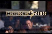
Church And State
1850 Industrial St
-
1
Tarryn Teresa Gallery
1820 Industrial Street, #230 -
2
City Hearts-kids Say Yes-arts
929 E 2nd St -
3
Heather Brown, Jacob Stewart-halevy, And Jonas Wood
542 S Alameda St -
4
City Hearts-kids Say Yes To The Arts
929 E 2nd St -
5
Beston Golf Incorporated
648 Mateo St -
6
Sci-arc Gallery
960 E. Third St. -
7
Esotouric's Secret Los Angeles
Call or Visit Us Online! -
8
Bonito Toys
1137 E 1st St
© 2026 LosAngeles.com: A City Guide by Boulevards. All Rights Reserved. Advertise with us | Contact us | Privacy Policy | Terms of Use | Site Map